Melek Gülmeral - 3
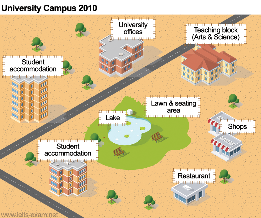
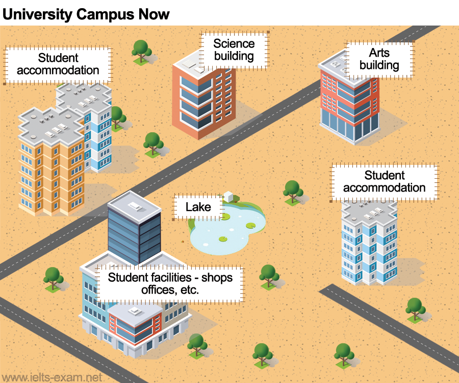
The maps show improvements that have been made to a university campus between 2010 and the present day.
Summarise the information by selecting and reporting the main features, and make comparisons where relevant.


The given two maps illustrate comparative data about the improvement of the universİty campus settlement from 2010 to the present. Overall, it can be seen that there have been many useful inovations on the buildings. In addition, the green area has been removed in this improvement plan.
To begin with, the most significant development has been made on student accommodation. They have been increased in number and size. In addition, student facilities, shops, offices, etc. have been combined in one big building instead of old student apartments that was on the westsouth of the campus. Furthermore, the art and science buildings have seperated into different locations. The old teaching block was destroyed and the new block has been turned into an art building. In a similiar trend, the student office was teared down and a new block has been used for science classes.
On the whole, regarding to the maps there is no shift with the location of the lake. It is still in the centre of the campus. However, the lawn and sitting area that was around the lake has been removed. As the last development of this plan, a new road was built on the eastside of the campus to make the access to the campus easier.


Comments
Post a Comment